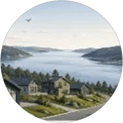
Maps and terrain
The maps the project owner has based the plan on, and a terrain map made for the website, in full size: property boundaries, contours, the sight line to the sea, the terrain profile and the first sketch of the site plan.
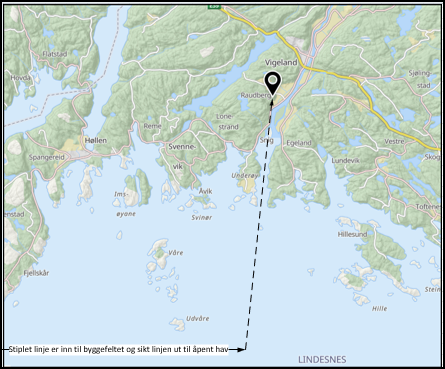
The sight line to the sea
The project owner's map: the dashed line runs in to the building site, and the sight line runs out to open sea. It goes from Raudberg past Snig and out Sniksfjorden. That is the direction the field faces.
Project owner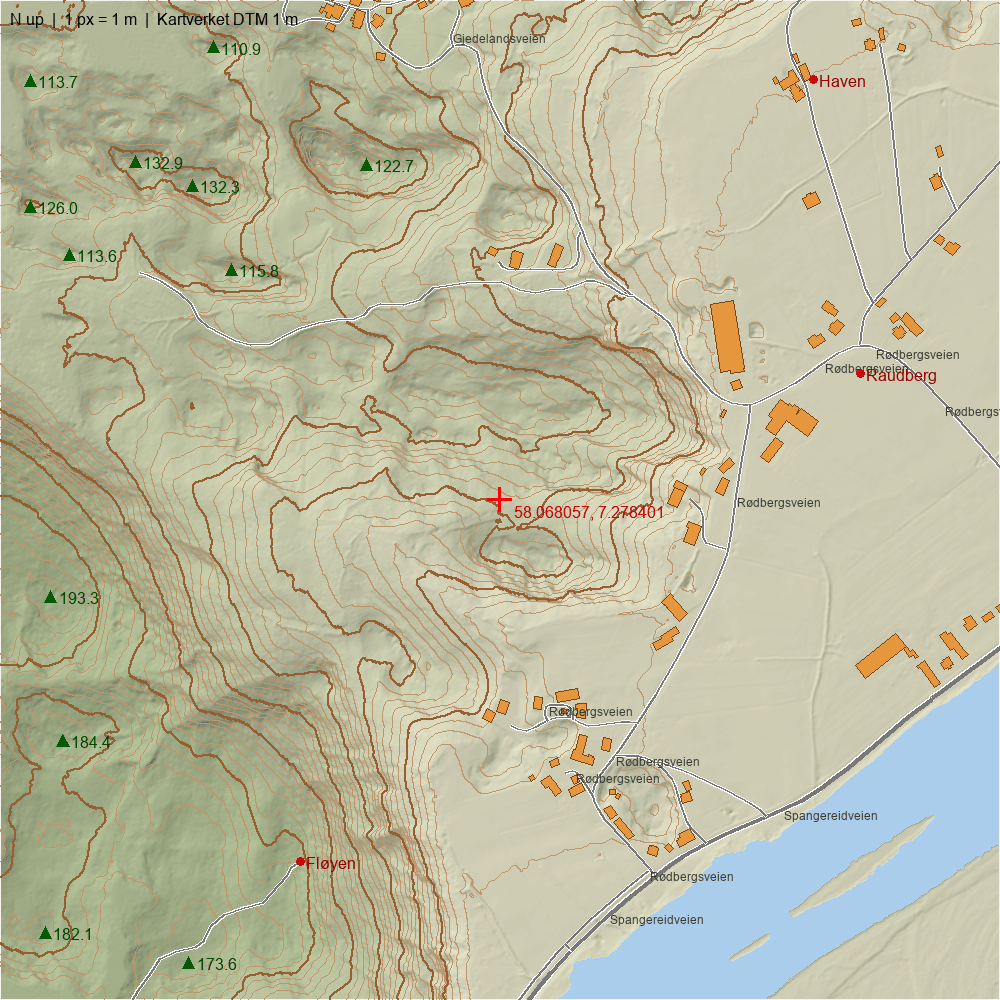
The terrain around Knotten
One kilometre around the field, drawn for the website from Kartverket's elevation model at 1 m resolution with 5 m contours. The red cross is the position 58.068057, 7.278401. The hills behind rise to over 190 metres, while the flat by the river lies close to sea level.
Made for the website: Kartverket DTM 1 m (CC BY 4.0), roads and buildings from OpenStreetMap (ODbL)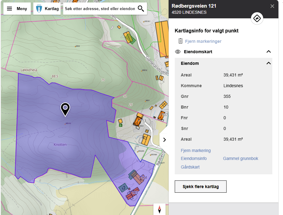
The property
Rødbergsveien 121, 4520 Lindesnes. Cadastral unit 355/10, 39,431 m². Together with 355/368 the area is 40,181 m².
Norgeskart, Kartverket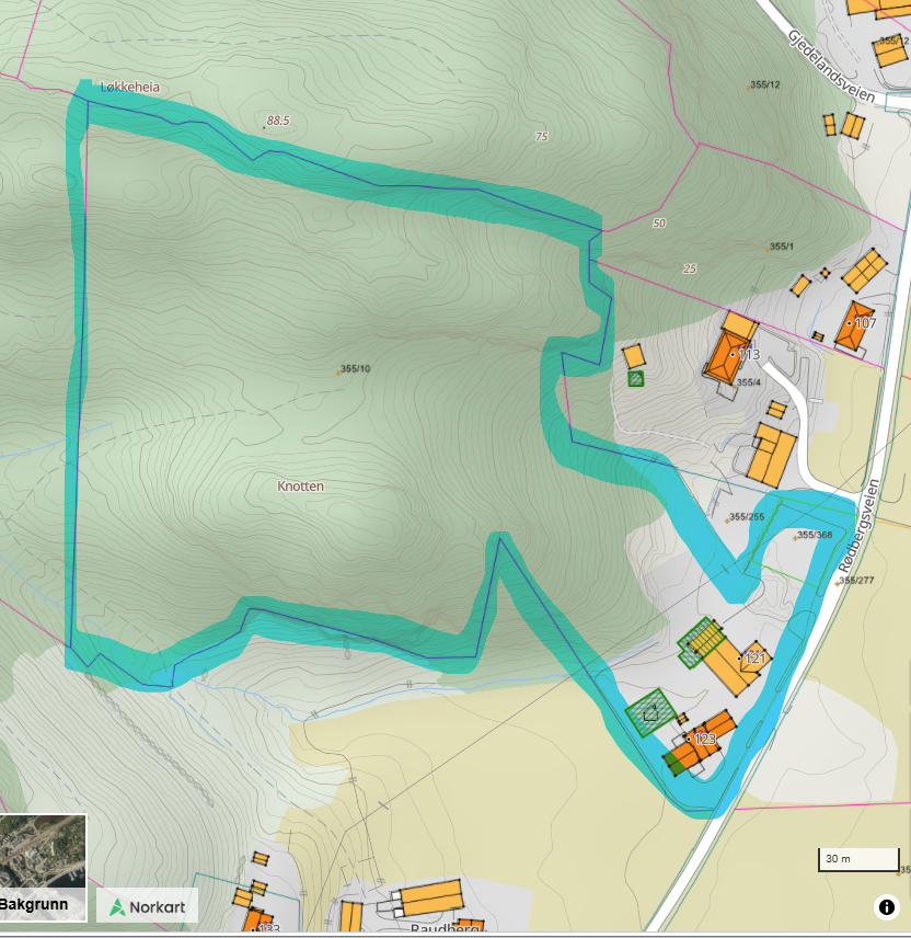
The project area
The area is marked in blue along the red property boundary. It covers the knoll Knotten and a narrower part down to Rødbergsveien by house numbers 121 and 123. Løkkeheia behind the field is 88.5 m above sea level. The project owner says plots down on the flat will not have a sea view.
Project owner, base map Norkart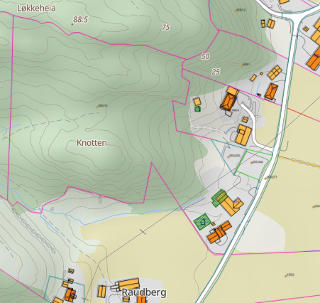
The buildings today and those planned
The orange buildings stand today. The two green ones are planned: an extension of the office building and a warehouse and workshop building directly behind the house.
Project owner, base map Norkart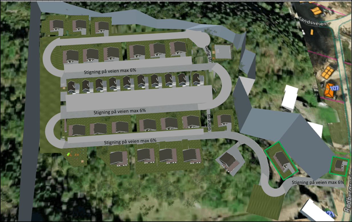
The site plan sketch
The project owner's first sketch: rows of houses along one road that hairpins up the field, footpaths between the rows, and the two planned buildings in green at the lower right. The sketch sets at most 6 percent gradient as the aim; on today's ground the road is steeper, so the zoning plan must give longer loops. The model puts four rows into the measured terrain inside the property boundary: A, B and C one above the other on the south slope and D on the knoll Knotten.
Project owner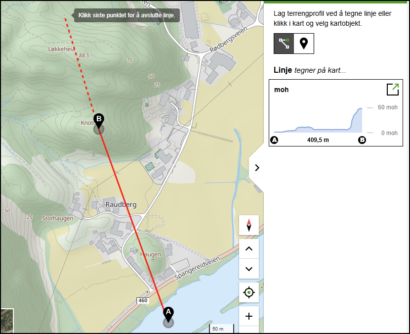
The terrain profile
From the water by Spangereidveien (A) to Knotten (B) is 409.5 metres. The profile is flat across the river plain and rises steeply up the knoll, from 0 to 60 metres above sea level. The flat part by the road is where the office building and the house stand today.
Norgeskart, Kartverket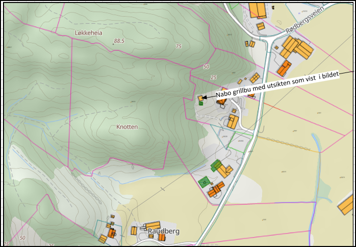
Where the view photo was taken
The project owner's note on the map: the neighbour's grill hut, with the view shown in the photo. The hut sits on the ledge east of Knotten, on the neighbouring plot, a little lower than the field.
Project owner, base map Norkart