About 30 homes on Knotten above Sniksfjorden in Lindesnes, laid out in the model in four rows across the south face and on the knoll. The aim is a sea view from every plot, but it is not certain every plot will get one. The journey below runs from the fjord all the way into the living room.
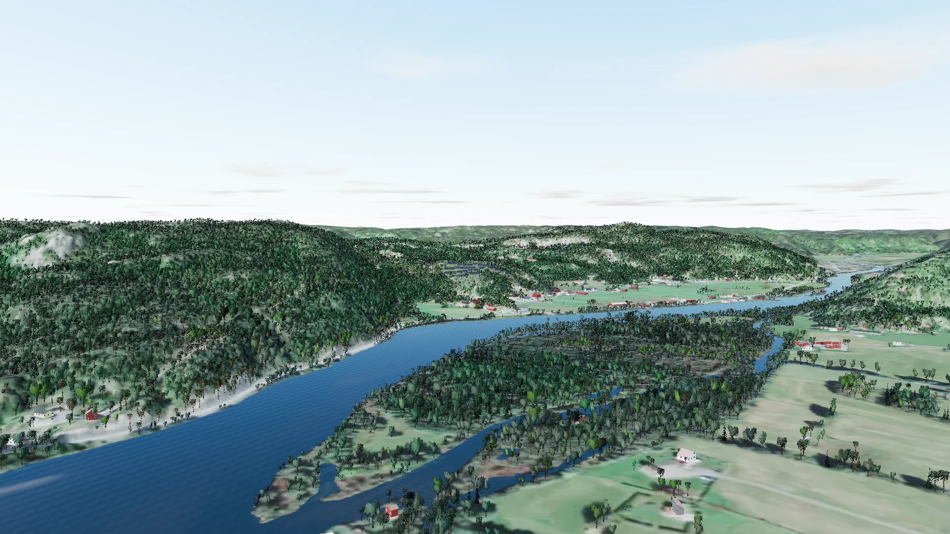
A 3D model of Knotten and its surroundings, built from measured data: the fjord, the field with its plots and an example house you can walk into. Sun, view and height for every plot are also given as text on the plot pages.
From the fjord, onto the field, down on the plot and into the living room. About half a minute.
The journey starts on its own. Click the model to take control, Escape hands the page back.Tap «Start the journey». Tap the model to take control, and outside it to scroll on.
About 30plots, the aim is a sea view from all
40,181 m²in total for the properties 355/10 and 355/368
Max 6 %grade is the aim for the road. On today's ground it is steeper, so the plan must give longer loops
Zoningnot adopted yet. The project starts before the zoning plan
The place
From the river up onto Knotten.
The field sits on a knoll just west of Rødbergsveien, near where the Audna flows into Sniksfjorden at Snig. At the bottom, between the road and the river, it is flat. Then the ground rises steeply, and from the rows up the slope the sight line runs south, out the fjord and to open sea.
The terrain profile is drawn in Norgeskart from the water by Spangereidveien to Knotten: 409.5 metres, from 0 to 60 metres above the sea.
A principle section, not to scale.Map basis: Kartverket
Right now at Knotten.
The weather
…
Sunset today
…
The power price now, NO2
…
This is how it looks today.
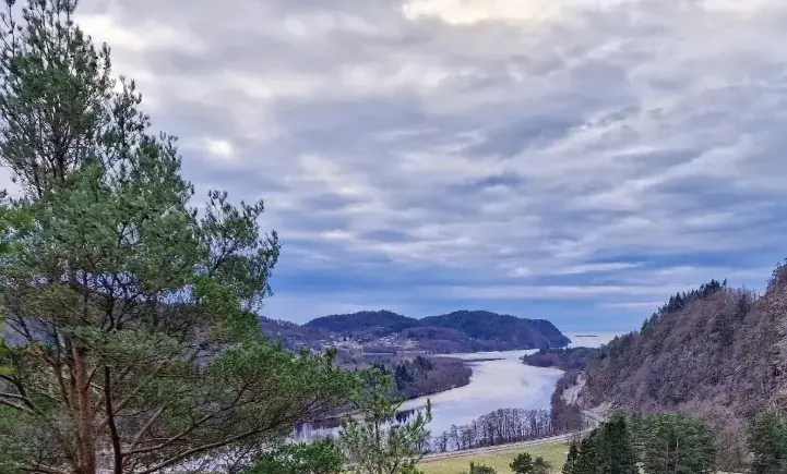
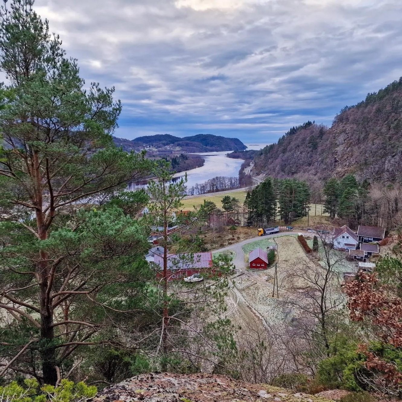
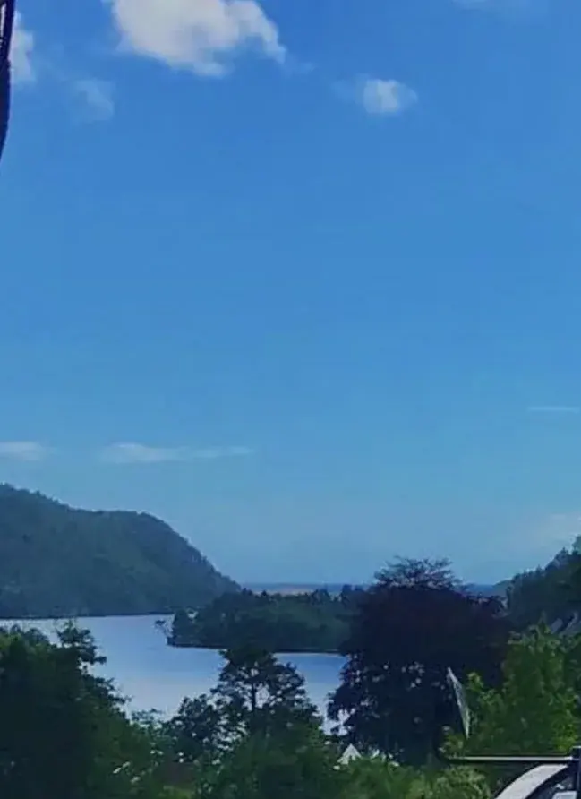
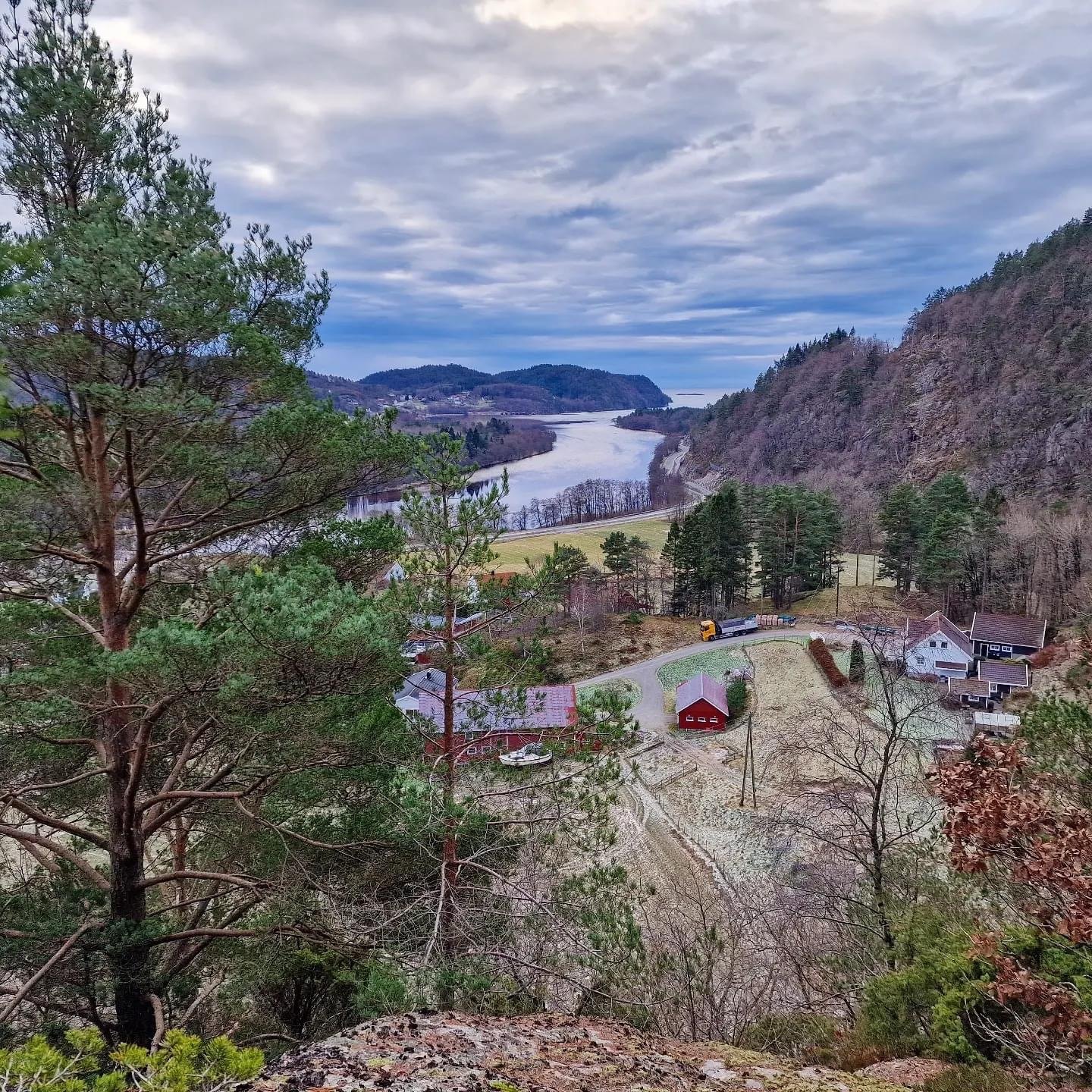
Photos from the project owner. The view photo was taken from the neighbouring plot, a little lower than the field; where the summer photo was taken is not stated.
The view south towards Sniksfjorden and the sea.The farms, the road and the river below the field.Summer over the fjord, with the sea in the gap between the hills.
The terrain is Kartverket's one-metre laser scan. The trees are found in the same dataset, as an estimate. The parcel boundary comes from the cadastre. The sun follows its real path over the real ridge, and every plot in the model's rows is checked against the water with the neighbouring houses standing.
31,823trees
Trees found in laser data on 1 km²
Treetop detection in laser data, the website's model, 2026-09-05 (provisional)
26°
Corridor to open sea
From the highest point, 164 to 189 degrees, the website's model, 2026-09-05 (provisional)
30plots
Plots with open sea in view, in the model
View analysis per plot with the neighbouring houses in place, the website's model, 2026-09-30 (provisional)
1,028trees
Trees cleared in the model's proposal
14 m around the houses, 6.5 m along the road, 2.5 m along the footpath and the trees in the sight line from each living room to the sea, the website's model, 2026-09-30 (provisional)
Photograph
Model
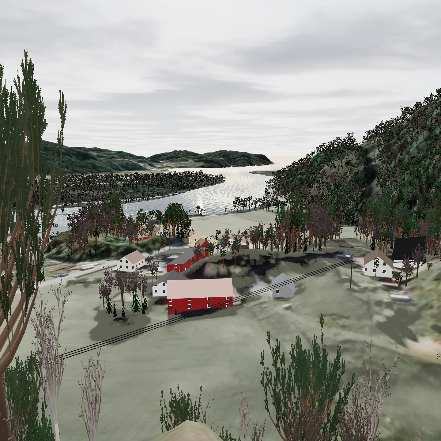
The view photo was taken by the neighbour's grill hut. The model camera stands where the photo was taken, found by fitting the photo's skyline and farm buildings to Kartverket's terrain model: 1.9 metres above the ground, towards 176 degrees. Drag the divider.
The maps behind the plan.
The project owner's own maps, from the sight line out to the sea down to the first sketch of the rows. Scroll, and the map changes.
1 of 8
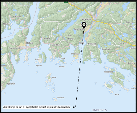
The sight line to the sea
The project owner's map: the dashed line runs in to the building site, and the sight line runs out to open sea. It goes from Raudberg past Snig and out Sniksfjorden. That is the direction the field faces.
2 of 8
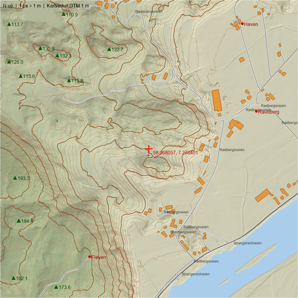
The terrain around Knotten
One kilometre around the field, drawn for the website from Kartverket's elevation model at 1 m resolution with 5 m contours. The red cross is the position 58.068057, 7.278401. The hills behind rise to over 190 metres, while the flat by the river lies close to sea level.
3 of 8
The property
Rødbergsveien 121, 4520 Lindesnes. Cadastral unit 355/10, 39,431 m². Together with 355/368 the area is 40,181 m².
4 of 8
The project area
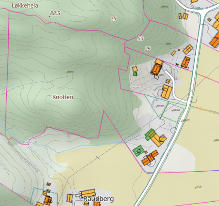
The area is marked in blue along the red property boundary. It covers the knoll Knotten and a narrower part down to Rødbergsveien by house numbers 121 and 123. Løkkeheia behind the field is 88.5 m above sea level. The project owner says plots down on the flat will not have a sea view.
5 of 8
The buildings today and those planned
The orange buildings stand today. The two green ones are planned: an extension of the office building and a warehouse and workshop building directly behind the house.
6 of 8
The site plan sketch
The project owner's first sketch: rows of houses along one road that hairpins up the field, footpaths between the rows, and the two planned buildings in green at the lower right. The sketch sets at most 6 percent gradient as the aim; on today's ground the road is steeper, so the zoning plan must give longer loops. The model puts four rows into the measured terrain inside the property boundary: A, B and C one above the other on the south slope and D on the knoll Knotten.
7 of 8
The terrain profile
From the water by Spangereidveien (A) to Knotten (B) is 409.5 metres. The profile is flat across the river plain and rises steeply up the knoll, from 0 to 60 metres above sea level. The flat part by the road is where the office building and the house stand today.
8 of 8
Where the view photo was taken
The project owner's note on the map: the neighbour's grill hut, with the view shown in the photo. The hut sits on the ledge east of Knotten, on the neighbouring plot, a little lower than the field.
A field built to look after itself as far as possible.
The energy concept is developed by the energy track, students from the University of Agder on an internship. The basis already exists: an energy budget for the whole field, a borehole field simulated in EED and an assessment of the measures. The figures are provisional and carry their source.
about 720,000 kWh/yr
Energy demand, whole field
30 homes, office and storage, with a range of ±25 %
243,567 kWh/yr
Solar from the roofs
The energy budget, which itself says the figure is about 30 % too high. The status summary estimates about 235,000 from 1,350 m²
499,846 kWh/yr
Heat from the bedrock
28 boreholes, about 106 m deep, seasonal factor 3.6
420 kWh
Battery in the field
14 kWh in every home, a chosen input in the energy budget
17 measures, 16 of them compared by the energy track and one from the project owner's direction.
YesRooftop solarBattery in every homeHeat recovery ventilationAir sealingGreywater heat recoverySmart load managementEnergy display for residents
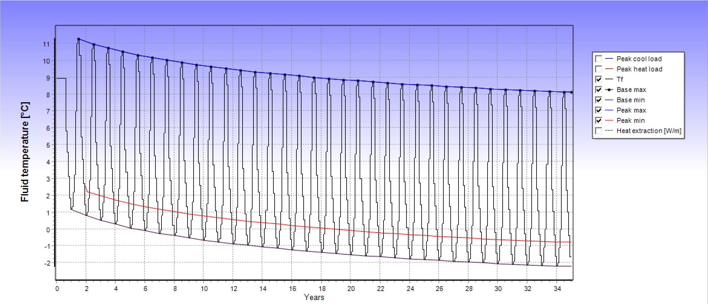
The borehole field simulated in Earth Energy Designer: 28 boreholes, 4 x 12, open rectangle, 15 m apart. The fluid temperature settles over 35 years; in the last year it stays between -0.78 and 8.12 °C. The energy track judges both to be good.
The direction from the project owner, 4 September 2026
Each home should have its own battery and energy management, with possible access to shared storage.
A microgrid should be investigated at a limited level, but it should not be a prerequisite for the project.
The sand battery should remain an option, but no major resources should be committed until the overall system is better defined. The sand battery has since been dropped.
The workshop and storage building may provisionally be dimensioned as one home, clearly marked as an assumption.
The office building should be estimated from actual consumption for the 19 completed offices, with an adjusted projection for 28 offices.
Most winter sun.
The sun passport is computed from the terrain around each plot on 21 December, at living-room height. It is the number a buyer at 58 degrees north actually wonders about.
Kartverket DTM 1 m and NOAA solar position. Terrain shading with the field cleared. Computed 2026-09-30 for provisional layout v6 (rows A to D), with the neighbouring houses standing.
Kartverket DTM 1 m and NOAA solar position. Terrain shading with the field cleared. Computed 2026-09-30 for provisional layout v6 (rows A to D), with the neighbouring houses standing.
Kartverket DTM 1 m and NOAA solar position. Terrain shading with the field cleared. Computed 2026-09-30 for provisional layout v6 (rows A to D), with the neighbouring houses standing.
Knotten on the cadastral map. The office building and the house by Rødbergsveien are there today; the two green buildings are planned.
Existing buildings
Buildings that already use power.
The office building with 19 offices today and 28 when the extension stands, and the house below it, are part of the energy picture from day one. They can be measured, and measured data is shown once collected. An extension to the office and a warehouse and workshop behind the house are planned, and sit in the model.
The project starts before the zoning plan. Here is where it stands, and what has to be in place before the next step. Everything on this page is updated when the plan and the reports arrive.
ZoningThe zoning plan is not adopted. The project starts before the plan, so the energy concept and the market are developed together.
Energy conceptThe energy budget, the borehole field and the assessment of measures exist as a provisional working basis. The technical report follows.
Sale through an estate agentThe plots are not for sale, and no prices are set. Plots, prices and schedule are given when the plan is adopted.
Building and measuringNo date is set. Actual performance is published once the homes stand, measured against the existing buildings.
The model now follows the plan's four rows, with the same plot numbers as the site plan: row A with plots 1 to 9 at the top below Løkkeheia, row B with 10 to 19, row C with 20 to 26 and row D with 27 to 30 on the Knotten knoll. Each plot is checked against the water with the neighbouring houses standing; all 30 see water, and all see open sea. The road is drawn behind the rows with hairpin bends as in the project owner's sketch, on today's ground; the regulated plan must give it longer loops and earthworks to keep to 6 percent. The layout is a computed proposal, not an adopted plan.
The model's layout v5: terraces, row under row
In the model the plots now sit in terraces across the south face: a row on every level, each row right under the one above, the way the project owner intends to shape the ground. In the model's proposal each of the 30 plots is checked against the water with the neighbouring houses standing; all see water, and 28 see open sea. The layout is a computed proposal, not an adopted plan.
About the developer
Who is behind it.
Knotten is developed by Sigve Simonsen AS, on building land the project owns itself by Rødbergsveien in Lindesnes. Sigve Simonsen is the managing director and project owner: he sets the direction and makes the decisions in the project.
The property already has an office building with 19 completed offices, being extended to 28, and a house. Both are in use, and their measured power consumption becomes the basis of comparison for the new homes.
19
offices completed today
28
offices after the extension
Working with the University of Agder
The project works with the University of Agder through an internship for students: 300 hours in two tracks, energy and technology, and market and profile. The figures on the website come from this work and from the project owner, and carry their source.
Want to know when the plots are released?
Register interest. You choose what we may use your contact for.